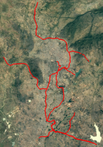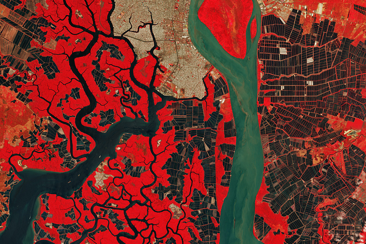
The Landsat 7 and Landsat 8 satellites captured these false-color images (bands 7-6-4) of the city in 2001 and 2021. This combination of shortwave infrared and red light makes it easier to distinguish developed areas (gray) from the surrounding grasslands (light green), forests (dark green), and farmland/bare land (yellow). The Landsat 7 and Landsat 8 satellites captured these false-color images (bands 7-6-4) of the city in 2001 and 2021. This combination of shortwave infrared and red light makes it easier to distinguish developed areas (gray) from the surrounding grasslands (light green), forests (dark green), and farmland/bare land (yellow).